Beneficial Use of Dredged MaterialDeal Island, Maryland

Deal Island BUDM Thin Layering

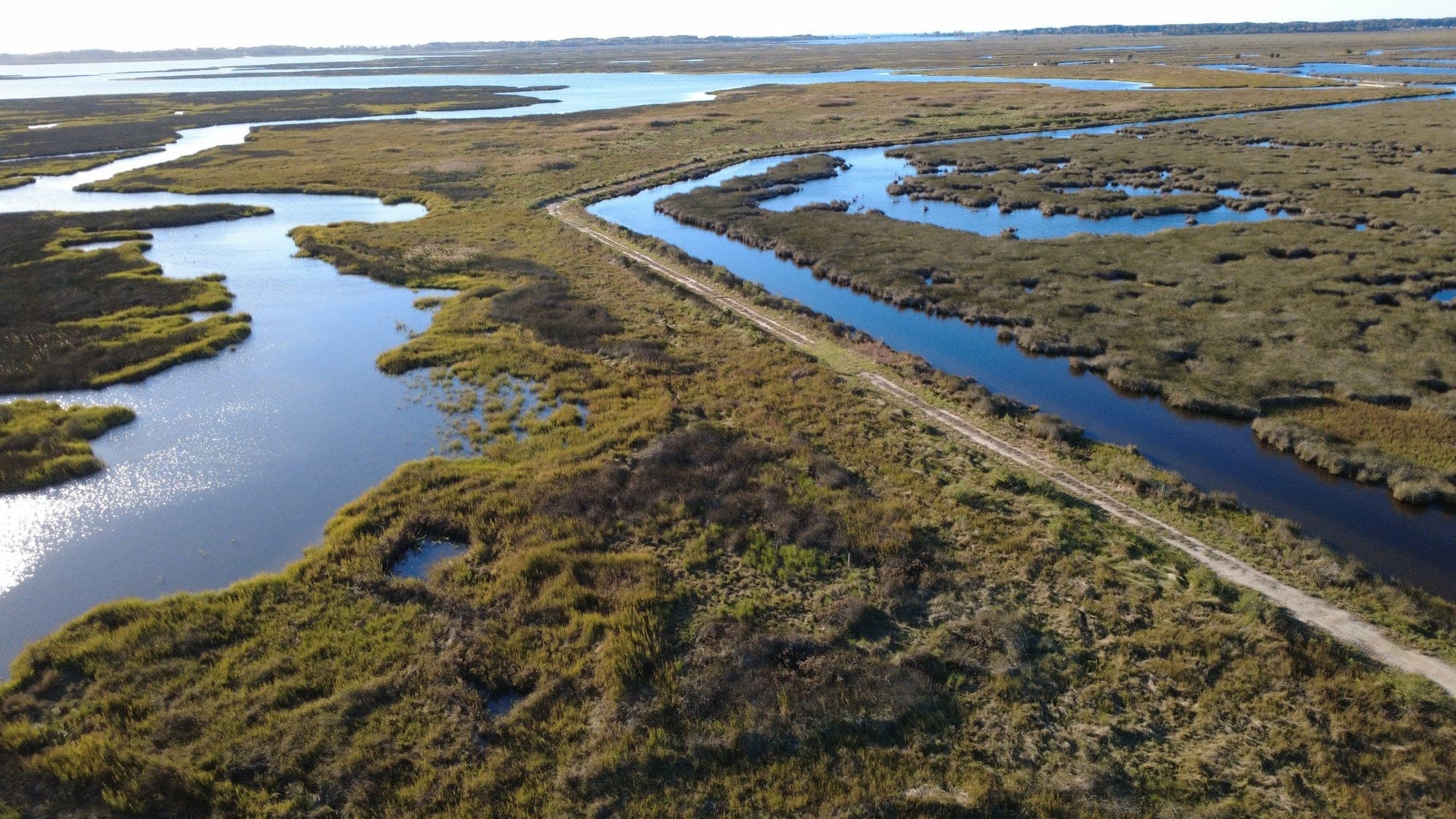
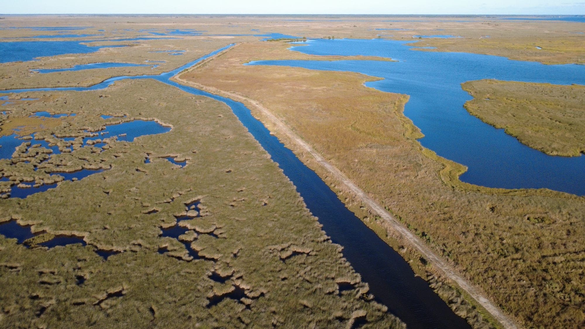
Tidal creek erosion and elevation loss were degrading 70 acres of salt marsh at Deal Island Wildlife Management Area and threatening the impoundment berm, while the U.S. Army Corps of Engineers Baltimore District needed a placement site for maintenance dredging of the Lower Wicomico River. The project joined the two needs: dredged material pumped 12.9 miles onto the marsh as a thin layer to rebuild a high marsh platform for Saltmarsh Sparrow nesting habitat. Sustainable Science set the 1.7 to 2.29 ft NAVD88 target from a year of tide and vegetation data, designed the ditch plug and straw bale containment, and served Wicomico County as independent environmental monitor and ecological engineer through placement, the planting of 750,600 marsh plugs, and the settlement and tidal monitoring that continues through 2026.

Download PDF summaryOne-sheet project summary (PDF)
Thriving marsh, creeks, and pannes
Target elevation
1.7-2.29 ft
Dredge volume place
161,306 cy
Plantings
750,600 plugs

Services provided

  • Construction monitoring
  • Thin layer design
  • Containment design
  • Regulatory compliance
  • Settlement monitoring
  • Tidal monitoring

Project overview

Deal Island Wildlife Management Area lies on Maryland’s Lower Eastern Shore in Somerset County, where tidal creek erosion and elevation loss were degrading 70 acres of salt marsh and threatening the impoundment berm. The marsh below the black needlerush zone was struggling and fragmenting while the black needlerush and higher communities remained robust. At the same time, the U.S. Army Corps of Engineers Baltimore District needed a placement site for maintenance dredging of the Lower Wicomico River federal navigation channel. The project joined the two needs: dredged material pumped onto the marsh as a thin layer to rebuild a high marsh platform and create Saltmarsh Sparrow nesting habitat on land managed by the Maryland Department of Natural Resources.

Sustainable Science joined the project in 2020 as design consultant to Audubon and Maryland DNR, and from 2023 served Wicomico County Public Works as independent environmental monitor and ecological engineer through containment construction, thin layer placement, marsh planting, and post-construction monitoring. USACE Baltimore District led the dredging and prepared the specifications and design drawings, Maryland DNR manages the site, and Audubon coordinates a monitoring team that includes NOAA, the U.S. Fish and Wildlife Service, the U.S. Naval Academy, UMCES, and Wicomico and Somerset Counties.

Investigation and target elevation

Sustainable Science installed a tide gauge on site in December 2020 and logged a full year of water levels, checked against the NOAA station at Bishops Head. In January 2021 the firm ran an RTK GPS survey of 723 points, recording the dominant vegetation species at each shot to ground truth the NOAA and DNR drone survey, and added a single beam sonar survey of the nearshore areas and probing of mudflat stability.

Pairing the tide record with vegetation elevations showed that regular flooding stops at about 1.0 ft NAVD88. The design target was set at 1.7 to 2.29 ft NAVD88: high enough for a Spartina patens and Distichlis spicata high marsh and for a surface that stays flood free over the Saltmarsh Sparrow’s 25-day nesting cycle, and below the regulatory maximum of 3.5 ft MLLW. The upper end of that range is inundated only about two days a year, mostly in autumn. Drawing on its thin layer work at Blackwater National Wildlife Refuge and on Poplar Island elevation trends, the firm planned an overfill of about 75 percent to allow for settlement.

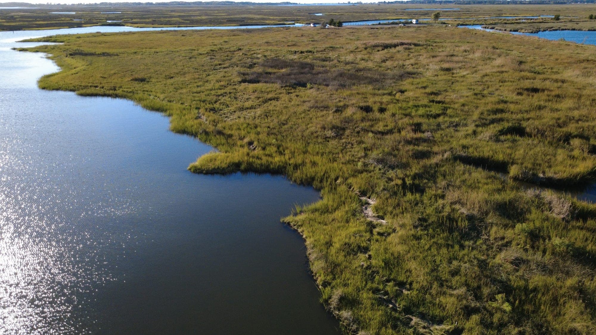
Continuous high marsh and tidal creeks
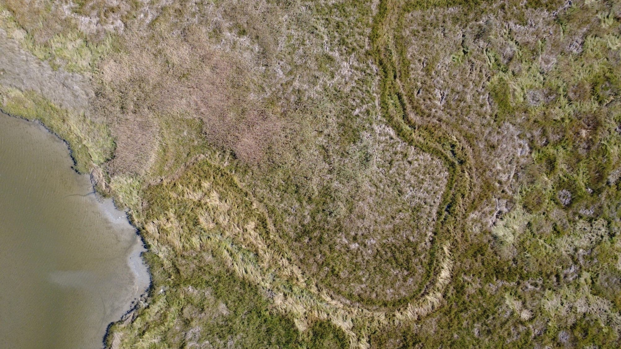
Diverse marsh vegetation from above

Containment design

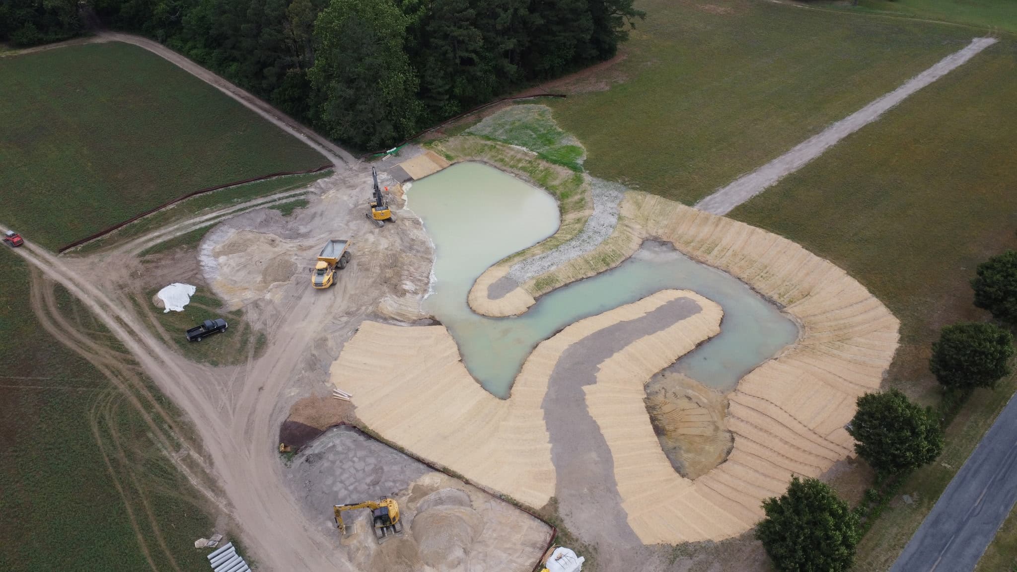
Fine-grained dredge slurry has to be held on the marsh long enough to settle. Sustainable Science designed the tidal channel ditch plug detail and material specifications for the USACE plan set: a geotextile and coir base, a sand and woodchip fill, a 15-foot top width, and 3:1 side slopes. The perimeter was a staked straw bale wall three feet tall, built from two rows of bales set two on the bottom and one on top. As built, the containment ran 6.25 miles, enclosing two sites with the second split into four subcells, and included 20 channel plugs.

During placement the firm’s adaptive management advice covered replacing bales damaged by storms, trampling, and aging, relocating the dredge discharge to stop short circuiting, and later removing bales at the ditch plugs to restore tidal exchange and reduce ponding.

Permitting

The Maryland Department of the Environment authorized the work under a tidal wetlands permit and license issued to Wicomico County Department of Public Works in November 2022, with a separate USACE federal permit. Conditions included no placement from mid-February through mid-October, a maximum final settled elevation of 3.5 ft MLLW, suspended solids and turbidity limits, 85 percent non-nuisance plant cover for three consecutive years, annual monitoring reports for five years, and an adaptive management plan. Sustainable Science carried out the adaptive management under that plan and prepared the ditch plug and straw bale as-built cross sections that supported a 2024 permit modification request.

Construction

Cottrell Contracting performed the hydraulic maintenance dredging of the Lower Wicomico River and pumped the slurry 12.9 miles through a 20-inch pipeline to the site. The route landed at Fannys Gut, crossed under Maryland Route 363, and ran about six miles along the impoundment berm. Containment was in place by September 20, 2023, placement ran from that date to December 21, 2023, and 161,306 cubic yards of dredged material were placed over the 72.5-acre placement area.

Sustainable Science monitored every phase: on-site inspection, bathymetry and volume tracking against the remaining cell capacity, regulatory compliance reporting, weekly updates, and construction coordination meetings. When field conditions called for it, the firm’s adaptive management advice adjusted the containment and the discharge location so that placement could continue inside the permit conditions.

Planting from the as-built surface

Rather than plant to the design drawings, the firm flew drone LiDAR and orthoimagery before placement and three times afterward, at about 450 points per square meter, and built surface models to map planting zones on the final surface: Spartina alterniflora and S. cynosuroides at the lowest elevations, Distichlis spicata in the middle band, and Spartina patens from 1.2 ft NAVD88 up. Most of the placed surface fell in the Spartina patens zone. The planting contractor began in May 2024, and 750,600 plugs, mainly Spartina patens and Distichlis spicata with smaller numbers of S. cynosuroides and S. alterniflora, were installed in 2024 and 2025 while the firm monitored installation and assessed planting density from growing-season orthoimagery.

Lush cordgrass edge and high marsh

Results and monitoring

Sustainable Science tracked settlement at 14 monitoring plots in two clusters about a mile apart, with LiDAR readings through the first year after placement and further flights in May 2024, November 2024, and August 2025. Site-wide settlement averaged 3.8 inches: 2.7 inches in the western cluster, largely stabilized within about five months, and 10.2 inches in the eastern cluster, which was still settling. Nine plots ended within the target range, two ended just above it, and three ended below it, where the firm recommended assessing vegetation in the 2026 growing season with thin layer reapplication as an option.

By mid-May 2024 the substrate was firm enough to walk on, and by October 2024 the site was thick with low marsh vegetation and channels were reforming. The firm delivered its settlement analysis in May 2026 and its full-year tidal hydrology analysis in June 2026, and NOAA is merging that data with three years of post-placement survey data for the monitoring team’s final report. Settlement, tidal, and LiDAR monitoring continue through 2026.

Key accomplishments

Reused ~160,000 cy of dredged material via thin layering

Enhanced/created 72.5 acres of tidal marsh habitat

Installed over 750,000 tidal marsh plugs

More projects - Other work from our team.

A look at the range of restoration, resiliency, and ecological design work Sustainable Science, LLC delivers.

Have a similar project in mind?

Contact Sustainable Science, LLC to discuss how we can support planning, permitting, design, and construction for your restoration or resiliency project.