Shoreline RestorationEdgewater, MD

Smithsonian Environmental Research Center Living Shoreline

At Cheston Point, where the Rhode and West Rivers meet at the Smithsonian Environmental Research Center near Edgewater, Maryland, a forested bank was eroding under a fetch that reaches Kent Island and the wakes of heavy boat traffic. Sustainable Science, designer of the original Cheston Point project, was retained in 2021 to resurvey the site, analyze how the shoreline had responded, and update the living shoreline design for Phases 1B, 1C, and 2, then prepared the alternatives, permit, and bid documents and secured USACE and MDE authorizations in 2024. Edwin A. and John O. Crandell, Inc. built the five Phase 1C breakwaters and the Phase 1B groin and breakwaters in 2024 and 2025, with Sustainable Science providing construction administration and as-built plans. The work restored 970 linear feet of shoreline and created new tidal marsh, which the firm now monitors for five years.

Download PDF summaryOne-sheet project summary (PDF)
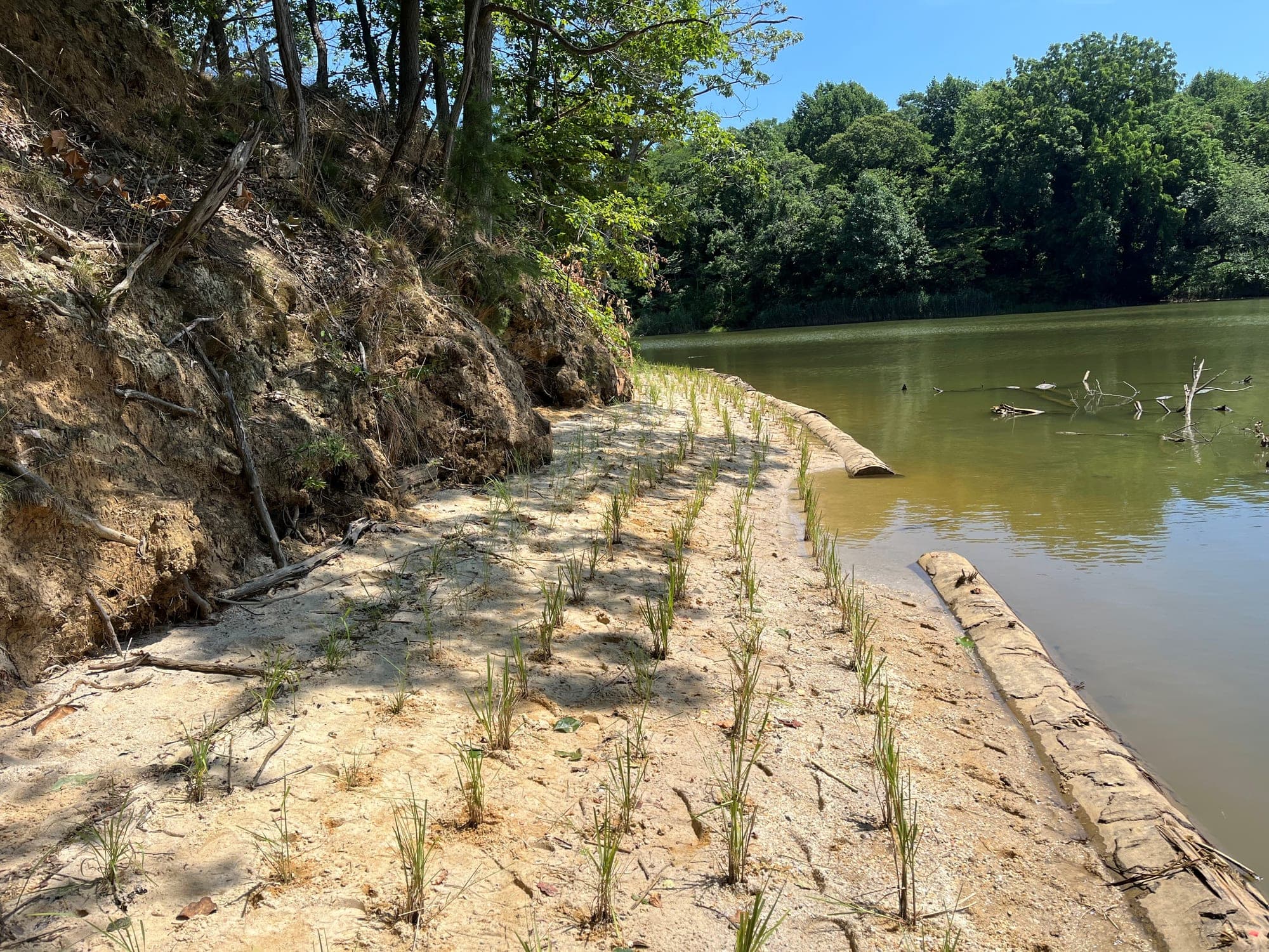
Looking north along Phase 1A
Shoreline restored
970 LF
Clean washed sand
5,000 TN
Stone nearshore breakwaters
3,700 TN

Services provided

  • Shoreline design
  • Permitting
  • Construction administration
  • Topographic/bathymetric survey
  • Post-construction monitoring
  • Wave/erosion analysis

Project overview

The Smithsonian Environmental Research Center’s campus covers 2,650 acres of the Rhode and West River watersheds on the western shore of Chesapeake Bay. At Cheston Point, where the two rivers meet, the shoreline was eroding severely: the point faces a fetch that reaches Kent Island, heavy boat traffic adds wakes to the wind-driven waves, and forest ran to the water’s edge above a four to six foot vertical undercut bank. SERC wanted the erosion halted and the point stabilized while adding habitat value, and it wanted the result to demonstrate best management practices on its educational river tours.

Sustainable Science had designed the original Cheston Point project and managed construction of its first phase, which built Phase 1A and part of Phase 1B under earlier state and federal permits. In 2021 the Smithsonian Institution retained the firm to update the design for Phases 1B, 1C, and 2, modify the permits, and prepare bid documents. Sustainable Science then administered construction of Phases 1B and 1C and now monitors the planted marsh.

Survey and analysis

Sustainable Science began with a topographic and bathymetric survey in September 2021. The firm built digital elevation models comparing the 2021 surface with the first phase’s as-built surveys and the 2010 design survey, and compared the boat-wake embayments that had formed against those predicted by the Sylvester and Hsu indentation ratio. Read with historical aerial imagery, the survey showed that Phase 1B needed modification to contain its planted sand substrate more fully, and that Phase 1C needed additional nearshore breakwaters to keep the Cheston Point peninsula from breaching.

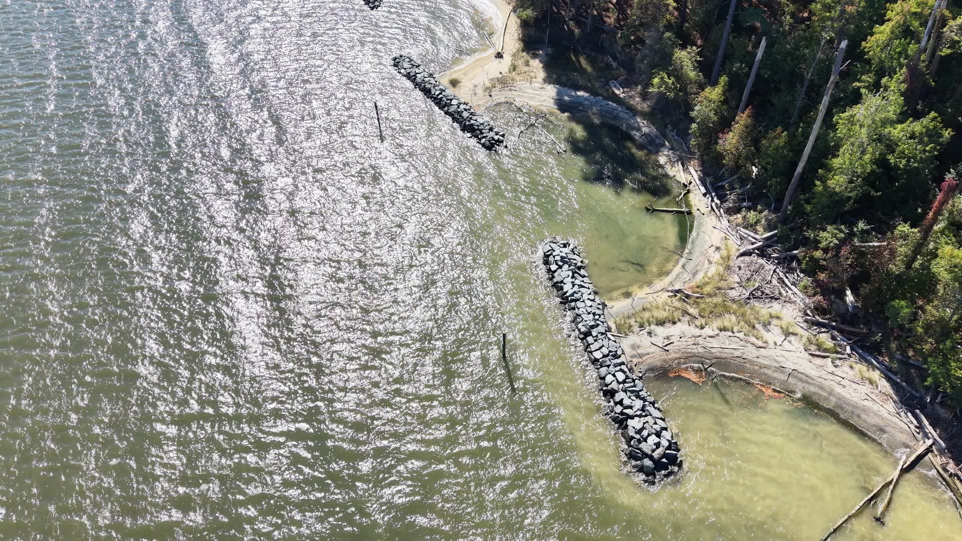
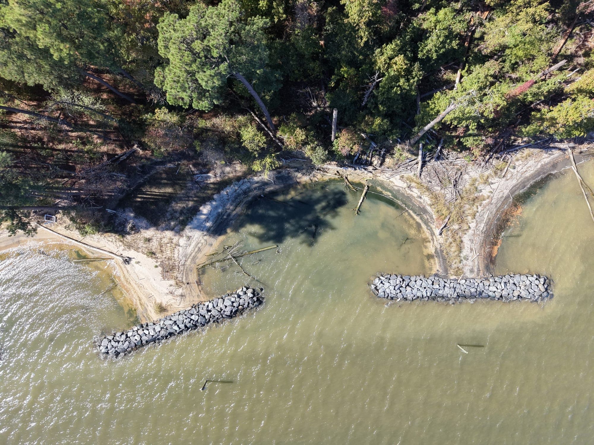
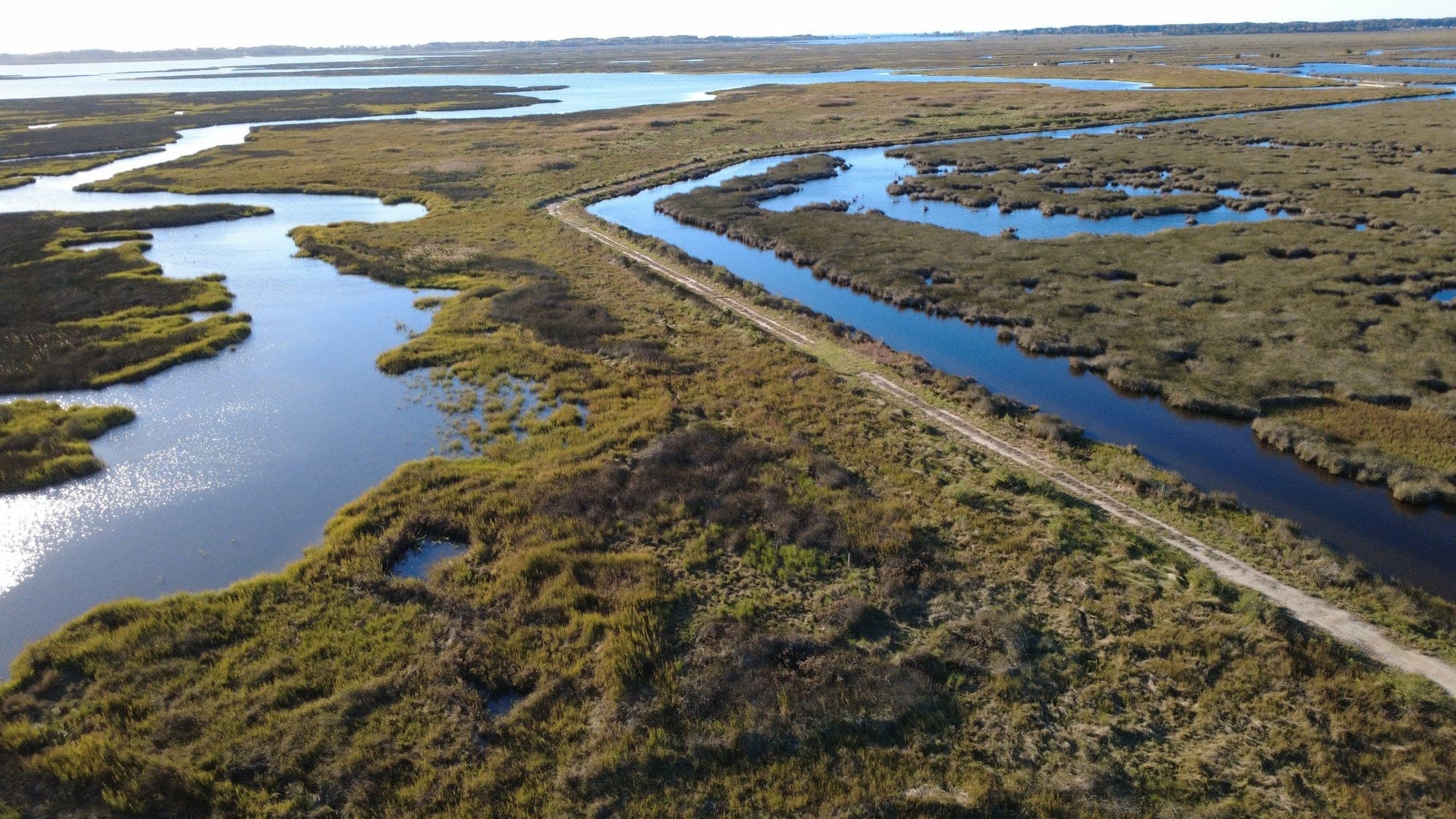
Aerial view of portion of Phase 1C

Design

For the reauthorization, Sustainable Science weighed four alternatives, no action, a revetted shoreline, nearshore breakwaters with planted sand substrate, and headland breakwaters with planted sand substrate, against erosion rate, protected width, habitat value, sea level rise protection, and impacts to submerged aquatic vegetation.

Nearshore breakwaters were selected for Phase 1 because of its high wave energy and narrow land width, and headland breakwaters for Phase 2, where boat wakes dominate and shallow-water habitat impacts are lower. All structures carry crests two feet above mean high water, which Maryland’s 2018 sea level rise guidance equates to protection through 2060.

Permitting

Acting as SERC’s agent, Sustainable Science met with the Maryland Department of the Environment and the U.S. Army Corps of Engineers before submitting a joint federal and state application in September 2022 to build the remaining phases of the 3,850-foot shoreline authorized under the earlier permits. The Maryland Board of Public Works issued the tidal wetlands license and MDE the water quality certification in February 2024, and the Corps validated the individual permit in June 2024. Reauthorization took about two years, and shoreline was lost in the interim. The permits bar in-water work from mid-November to the start of March because the site lies in a Historic Waterfowl Concentration Area, and they require the marsh to reach 85 percent cover for three consecutive years.

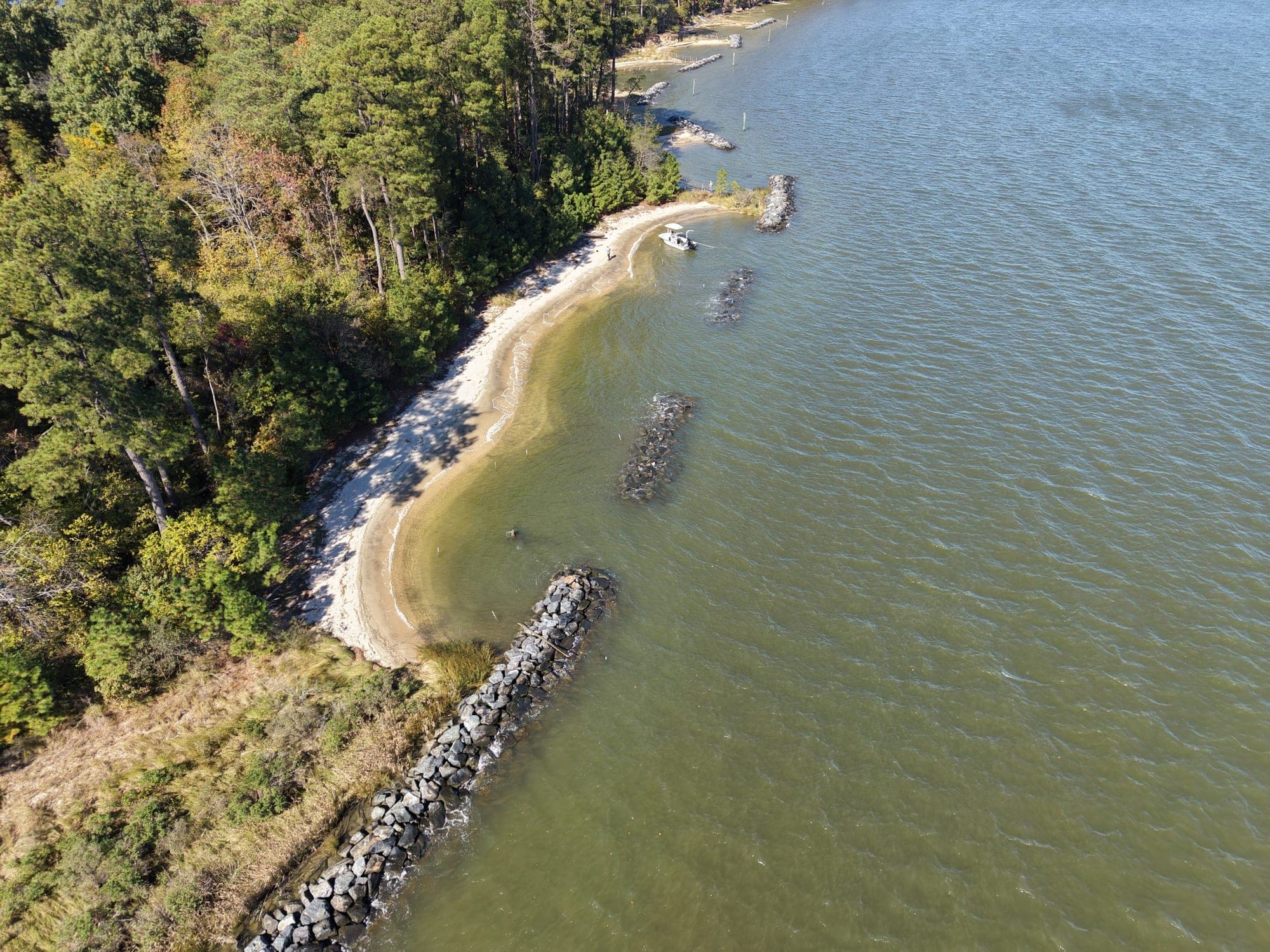
Looking north along Phase 1C

Construction

Phase 1C was built first, with Phase 1B added as the work went on. Associated Builders, Inc. held the construction contract and Edwin A. and John O. Crandell, Inc. of West River, Maryland carried out the marine work. Sustainable Science reviewed submittals, staked the layout with RTK GPS, and approved materials and field changes. In August 2024 it refined the layout, widening the breakwater crest from two feet to four feet and moving BW-4 and BW-5 fifteen feet landward to shift sand toward the eroded downriver area.

Crandell built the five Phase 1C breakwaters, BW-1 through BW-5, in the fall of 2024, completing the first three by the start of November and finishing rock placement under a partial waiver of the waterfowl restriction before demobilizing for the winter. Sand and cobble placement began in April 2025 and finished in mid-May. Phase 1B followed in August 2025 with a stone groin and two breakwaters, the groin’s end tied into the bank in a field change Sustainable Science and SERC approved because it reduces the risk of undermining. Wetland planting was finished on October 8, 2025, the Phase 1B stonework on October 13, and the project was reported complete in November 2025.

Looking south along Phase 1C

Results and monitoring

The completed work restored 970 linear feet of eroding shoreline at Cheston Point with 5,000 tons of clean washed sand, 3,700 tons of stone in nearshore breakwaters, and 25,850 square feet of planted tidal marsh vegetation. As the sand went in, Sustainable Science observed the first embayment shaping up as predicted and the raised stone blocking yacht wakes. After the post-construction survey in October 2025 the firm found that the constructed work matched the design exceptionally well, and it issued signed and sealed as-built plans at the end of that month.

In January 2026 Sustainable Science submitted the as-built plans, baseline photographs, and an adaptive management and maintenance plan to MDE, the Corps, the Maryland Department of Natural Resources, and the National Marine Fisheries Service as the first-year monitoring submission, and the Corps inspected the site and confirmed in June 2026 that the constructed work complies with the permit. Under the plan SERC maintains the shoreline for a minimum 15-year project lifespan, and Sustainable Science monitors the marsh each spring and fall and compiles annual reports to MDE, the Corps, and NMFS for five years.
Key accomplishments

Restored eroding shoreline at SERC's Cheston Point

Built five rock breakwaters (BW-1 to BW-5), Phase 1C

Completed Phase 1B breakwaters and stone groin

Placed over 8,500 tons of material to restore shoreline

Planted over 25,000 SF of tidal marsh vegetation

Secured USACE and MDE permits for construction

More projects - Other work from our team.

A look at the range of restoration, resiliency, and ecological design work Sustainable Science, LLC delivers.

Have a similar project in mind?

Contact Sustainable Science, LLC to discuss how we can support planning, permitting, design, and construction for your restoration or resiliency project.