Shoreline Restoration
Sustainable Science, LLC designs and delivers living shorelines and hybrid stabilization projects across the Chesapeake Bay and Delmarva region, from survey and wave analysis through MDE and USACE permitting, construction administration, and marsh monitoring.
Our approach
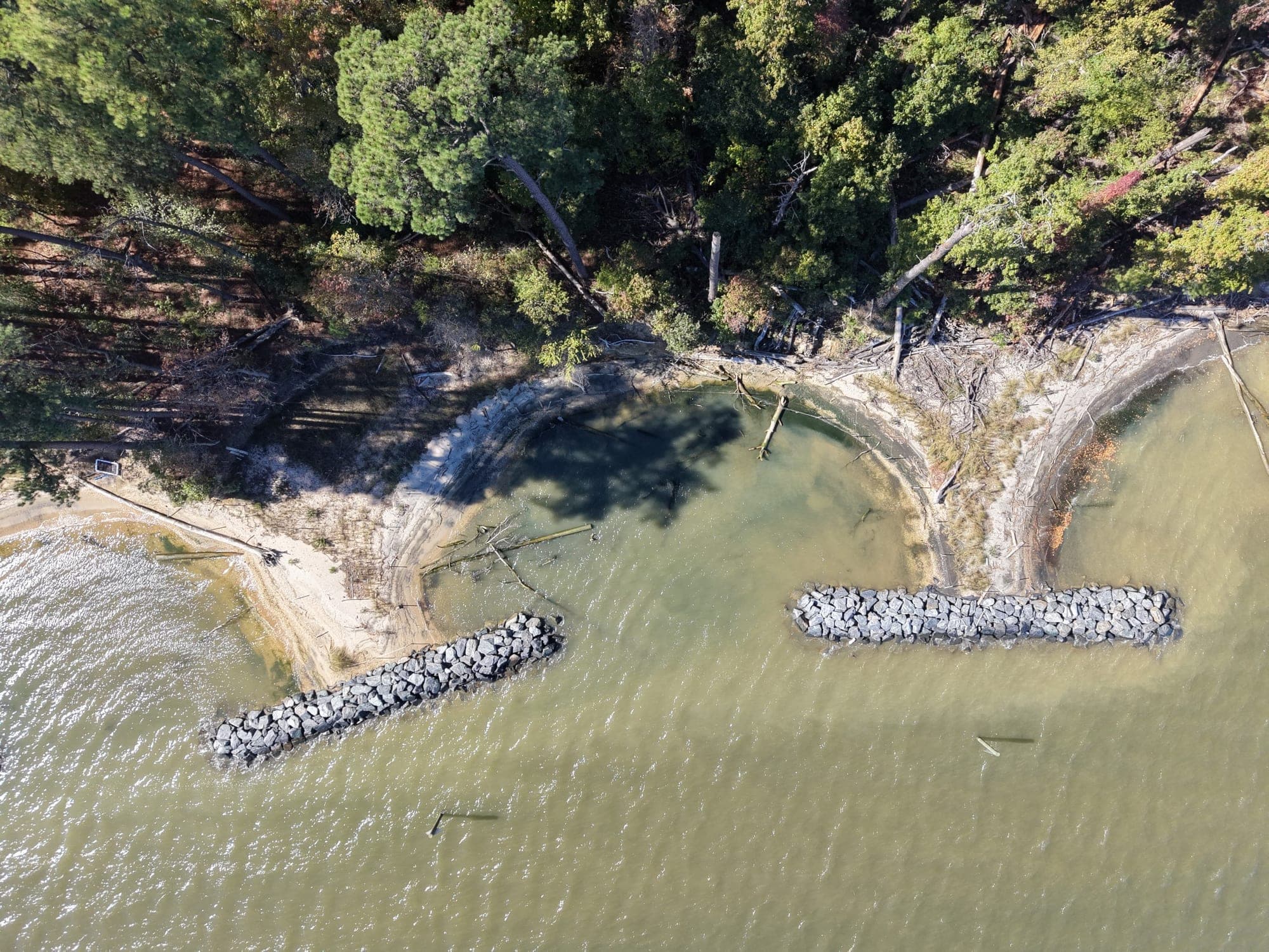
Every shoreline project starts with a topographic and bathymetric survey, a fetch and wave exposure analysis, and a look at how the bank has changed over time. From there we size and lay out the structures the site actually needs: stone breakwaters or headlands where the fetch is long, low stone or log sills where it is short, sand nourishment graded to the tidal datums, and tidal marsh planted on the new substrate. We set crest elevations against current water level datums and sea-level rise guidance, prepare the construction plans and permit drawings, act as the owner's agent with MDE and USACE, stake the work with RTK GPS, administer construction, and survey the as-built shoreline. Where a license requires it, we monitor the planted marsh through the five-year reporting period.
Typical analyses and design considerations
- Fetch, wind wave, and boat wake exposure
- Topographic and bathymetric survey of the bank and nearshore
- Historical shoreline change and erosion rate
- Tidal datums, water level analysis, and sea-level rise projections
- Breakwater, sill, headland, and groin layout and sizing
- Sand fill volume, grading, and marsh planting zones
- Submerged aquatic vegetation, tree, and cultural resource impacts
- MDE tidal wetlands licensing and USACE authorization
- Construction access, staging, and in-water work windows
- Post-construction marsh monitoring and adaptive management
Project applications
Eroding waterfront on research campuses, military installations, parks, conservation land, community shorelines, and private property throughout the Chesapeake Bay watershed, including phased projects that build on earlier permits.
Related services - Often paired with this work.
Restoration and resiliency projects rarely involve a single service. These are the services we most often deliver alongside this one.
- Coastal Engineering. Fetch and wave analysis, shoreline change assessment, water level and sea-level rise projections, and structure layout for communities and property owners. Learn more →
- Beneficial Use of Dredged Material. Putting dredged sediment to work rebuilding tidal marsh, shorelines, and islands through thin-layer placement and containment design. Learn more →
- Permitting & Regulatory Coordination. Pre-application meetings, Joint Permit Applications, MDE and USACE authorizations, and county approvals handled alongside the design. Learn more →
Have a project in mind?
Contact Sustainable Science, LLC to discuss how we can support planning, permitting, design, and construction.